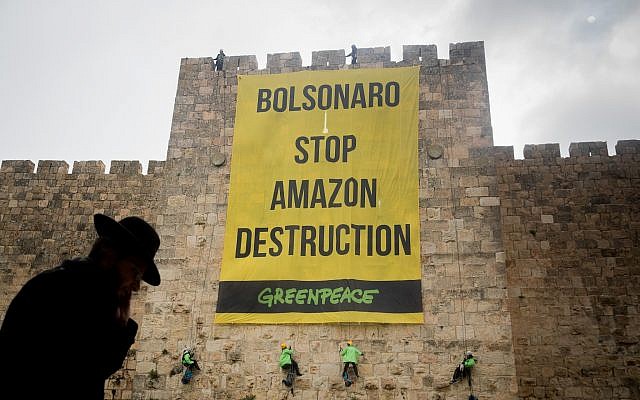
As Brazil’s Bolsonaro Wages War on the Amazon, Rainforest Communities Battle Climate Emergency
“We know what happens when the state does nothing. We know how quickly the forest can disappear.”
Alexander Zaitchik / The Intercept
(July 6, 2019) — The River Basin at the center of Latin America called the Amazon is roughly the size of Australia. Created at the beginning of the world by a smashing of tectonic plates, it was the cradle of inland seas and continental lakes.
For the last several million years, it has been blanketed by a teeming tropical biome of 400 billion trees and vegetation so dense and heavy with water, it exhales a fifth of Earth’s oxygen, stores centuries of carbon, and deflects and consumes an unknown but significant amount of solar heat.
Twenty percent of the world’s fresh water cycles through its rivers, plants, soils, and air. This moisture fuels and regulates multiple planet-scale systems, including the production of “rivers in the air” by evapotranspiration, a ceaseless churning flux in which the forest breathes its water into great hemispheric conveyor belts that carry it as far as the breadbaskets of Argentina and the American Midwest, where it is released as rain.

In the last half-century, about one-fifth of this forest, or some 300,000 square miles, has been cut and burned in Brazil, whose borders contain almost two-thirds of the Amazon basin. This is an area larger than Texas, the U.S. state that Brazil’s denuded lands most resemble, with their post-forest landscapes of silent sunbaked pasture, bean fields, and evangelical churches.
This epochal deforestation—matched by harder to quantify but similar levels of forest degradation and fragmentation—has caused measurable disruptions to regional climates and rainfall. It has set loose so much stored carbon that it has negated the forest’s benefit as a carbon sink, the world’s largest after the oceans.
Scientists warn that losing another fifth of Brazil’s rainforest will trigger the feedback loop known as “dieback,” in which the forest begins to dry out and burn in a cascading system collapse, beyond the reach of any subsequent human intervention or regret. This would release a doomsday bomb of stored carbon, disappear the cloud vapor that consumes the sun’s radiation before it can be absorbed as heat, and shrivel the rivers in the basin and in the sky.
The catastrophic loss of another fifth of Brazil’s rainforest could happen within one generation. It’s happened before. It’s happening now.
Mauro Toledo Rodrigues contributed reporting. Read the full article here.
© 2019 The Intercept / First Look Media
Land Thieves Ramp Up Deforestation in Brazil’s Jamanxim National Forest
Sue Branford and Thais Borges / Mongabay
(July 8, 2019) — Deforestation in the Brazilian Amazon has started to increase very rapidly, with 73,900 hectares (182,600 acres) of forest felled in the single month of May this year. May is always a month when deforestation rises, because it marks the end of the rainy season for much of Amazônia, but this year’s figure is a 34 percent increase over May 2018, when 55,000 hectares (135,900 acres) were felled.
According to DETER (System of Detection of Deforestation in Real Time), which compiled the data, it’s the highest single-month figure in more than a decade.
The DETER figure for accumulated deforestation from end of August 2018 to end of May 2019, compared with the same period in 2017/2018, shows a much more modest rise, from 348,700 hectares (836,946 acres) to 365,470 hectares (903,096 acres), an increase of 4.8 percent. The May 2019 figure supports anecdotal evidence that land thieves have become much more aggressive this year.
“If this upward curve continues, we could have a bad year for the Amazon forest,” Claudio Almeida, the head of satellite monitoring at INPE, the Brazilian aerospace institute, which runs DETER, told Reuters. “It will depend on how much policing there is in the next two critical months,” he added.
However, with the current state of paralysis within the country’s main environmental agencies, it seems unlikely that the authorities will be cracking down heavily on illegal deforesters in the coming months.
DETER recommends caution in the use of its data, because its satellite-imaging technology can’t penetrate thick cloud and so can be inaccurate. The official annual figures on how much forest has been felled in Amazônia are calculated with the use of different methodology, known as PRODES, and are published at the end of July, also by INPE.
However, DETER’s data are widely regarded as a reliable indicator of trends, and the system is currently detecting high levels of deforestation in protected areas — national forests, national parks and indigenous areas.
Even though under Brazilian law, these are clearly signposted as no-go areas for deforesters, land thieves and loggers have increasingly moved into them: according to figures from Imazon, the Institute for the Man and Environment in Amazonia, a nonprofit that promotes sustainability in the Amazon, deforestation in protected areas rose from 7 percent of total deforestation in 2008 to 13 percent in 2017.
Many of those living in protected areas believe that the political climate under the administration of President Jair Bolsonaro is encouraging the invasions by loggers into protected areas.
“All this hostile talk about the indigenous people from the new government is encouraging invasions,” Awapu Uru-Eu-Wau-Wau, a leader of the Uru-Eu-Wau-Wau people, told the NGO Socioenvironmental Institute (ISA). The critical period for this people, who live in Rondônia in the west of the Brazilian Amazon, begins in April when the end of the rainy season provides a dry window for invaders, and continues until October when the rains begin to fall again.
According to the Kanindé Association, a nonprofit that monitors deforestation in the Uru-Eu-Wau-Wau Indigenous Territory, about 180 outsiders illegally invaded the reserve in April. Ivaneide Bandeira, Kanindé’s coordinator, says that Bolsonaro’s announcement that he would be redrawing the boundaries of some indigenous reserves encouraged the illegal invasions.
DETER’s data show that the protected areas under greatest pressure are in Pará state in the east of the Amazon Basin, where the economic frontier is advancing rapidly and land prices are rocketing. Of the 10 protected areas in the Amazon with the highest levels of deforestation, eight are located in Pará. The area being most heavily despoiled is Jamanxim National Forest, where 44,800 hectares (110,700 acres) of forest were illegally felled in May alone.

In other words, Jamanxim lost more than 3 percent of its tree cover in just one month. Considerably less damage occurred in the next most threatened protected area — the Tapajós Area of Environmental Protection — which, proportionally, experienced less than a quarter of Jamanxim’s deforestation rate in May.
While forest loss slowed somewhat in Jamanxim in June, satellite data collated by the University of Maryland recorded around 22,000 deforestation alerts. Most of these occurred in the last week of the month, indicating another hike in clearance may be in store for July.
Jamanxim National Forest is a dramatic example of what can happen to a protected area when it is deprived of effective policing, which is the situation that INPE’s Claudio Almeida was describing.
Jamanxim National Forest was created in February 2006 as part of a package of measures to prevent deforestation along the BR-163, a 1,765-kilometer (1,097-mile) highway that links Cuiabá, the capital of Mato Grosso state, with the port of Santarém on the Amazon River. Soy farmers from Mato Grosso, which had just become Brazil’s main soy-producing state, were pressing for the road to be asphalted so that they could export the soy along the Amazon River instead of having to send it to ports in the south of the country, which incurred heavy transport costs.

The government agreed to the farmers’ demand and, to placate environmentalists who were concerned that the road would lead to high levels of deforestation, launched with considerable fanfare the Sustainable BR-163 Plan, which, it claimed, would demonstrate once and for all that the paving of roads and forest protection were compatible.
But this plan was soon eclipsed by the Program for the Acceleration of Growth (PAC), announced in 2007, which, with even more publicity and far greater resources, promoted investment in infrastructure, with scant mention of environmental protection.
Juan Doblas, who at the time was monitoring regional deforestation for ISA, said: “Ten years [after the Sustainable BR-163 was announced] the levels of deforestation were as bad as in our worst projections … The loss of forest was so out of control that for every year between 2004 and 2013 — except 2005 — while deforestation in Amazonia as a whole fell, it increased in the region around the BR-163.”
One of the most heavily invaded areas was Jamanxim National Forest, which covers 1.3 million hectares (3.2 million acres). On paper, it enjoys rigorous protection; only small-scale deforestation, carried out by traditional communities and researchers, is permitted.
Although officials from the environmental agency, IBAMA, tried to apprehend invaders, they didn’t have the resources to do the job properly. Land thieves continued to enter, at times threatening IBAMA officials, and they began to put pressure on federal deputies to put a bill through Congress that would remove the protected status from a large section of the national forest and reclassify it so that their occupation could become legal.
In 2009, they called for 305,000 hectares (735,700 acres) of the national forest to be turned into an area of environmental protection (APA), a much less restrictive form of conservation unit where faming and mining are permitted.
One of the main lobbyists for the reclassification was Ubiraci da Silva, known as Macarrão, the mayor of Novo Progresso, a frontier town on the BR-163 in Pará state. Founded in 1991, the town sprang up around a clandestine land strip built to promote a rapid way in and out for those engaged in illegal logging and gold mining.
During the soy harvest, truck after truck trundles through the town, leaving clouds of hot dust. Macarrão says that the town needs to exploit Jamanxim’s resources in order to survive.
“We are becoming nothing more than a transport corridor,” he complained to the Folha de S. Paulo newspaper. “We are hemmed in on one side by an indigenous reserve and it’s only on the other side, near Jamanxim National Forest, that we can produce. If the government doesn’t give in to our demand [to reduce the size of the national forest], our town will die.”
Some of the main businessmen and politicians in Novo Progresso would benefit personally from the creation of the APA. Imazon investigated and found that 71,000 hectares (175,400 acres) of the 305,00 hectares (735,700 acres) had been illegally occupied, most of it after the area had been turned into a national forest. IBAMA had issued 334 fines for illegal deforestation.
Both Macarrão and Ezequiel Antonio Castanha, the owner of a large supermarket in Novo Progresso and considered by the Federal Prosecution Service (MPF) as one of the biggest land thieves in the Amazon, were fined, though it seems that the fines were never paid. In 2014, IBAMA, the Federal Police and the MPF launched Operation Castanheira (named after Castanha), an ambitious but ultimately unsuccessful attempt to break up the land-stealing gang. Castanha was arrested but later released.
The land thieves are not grabbing land to farm it themselves, but have realized that, by deforesting it and selling it on, they can make a vast amount of money. One resident, who preferred to speak off the record, explained to Mongabay how it works:
“Land theft is part of the process of occupying the region around Novo Progresso. What is land theft? It’s an easy way of making money. The land grabber takes over an area of forest, generally forest that is worth very little, and deforests it. He doesn’t want to farm it himself but to sell it on. He deforests it very cheaply, using poorly paid labor, plants pasture and then sells it to a rancher who really wants to use the land.
“This process has been going for a decade or more. And the land increases in value by an absurd amount. Standing forest is almost worthless. Once it is cleared of vegetation, it increases in value 100 or 200 times.”
At the end of 2016, after heavy lobbying, the administration of then President Michel Temer gave way to the demands of the land thieves. Temer sent a bill, MP 756, to Congress to reduce the size of Jamanxim National Forest.
Environmentalists protested vociferously and the government withdrew the project. But Heron Martins, a researcher at Imazon, says he believes the bickering has only encouraged further illegal invasions.
“Every time the government puts forward a bill or emits a sign that it is in favor of a reduction [in the size of the forest], expectations increase and the number of illegal occupations grows, [even if eventually the initiative is abandoned],” Martins said.
In April 2108 the Supreme Federal Court, Brazil’s court of last resort, ruled in a unanimous vote that it was unconstitutional to reduce the size of protected areas by means of a kind of presidential decree called a provisional measure. But the decision has had little impact on the ground, with land thieves confident that eventually their exploitation of the forest will be legalized. The invasions are accelerating, as indicated by the recent figures.
What is happening in Jamanxim National Forest may be particularly shocking, but it is not an isolated case. On June 5, World Environment Day, the Amazonian Network of Georeferenced Socioenvironmental Information RAISG), which brings together researchers from six Amazonian countries, published a series of maps showing that at least 69 percent of the region’s protected areas, including indigenous reserves, are under some kind of pressure. Its maps encompass the eight countries of Panamazônia, and can be found in a multimedia platform titled Amazônia at a Crossroads. Their conclusion: that the Amazon region is under pressure as never before.
This piece was originally published by Mongabay. Posted in accordance with Title 17, Section 107, US Code, for noncommercial, educational purposes.